1.- INTRODUCTION TO THE INCA TRAIL AND ITS ELEVATION CHALLENGES
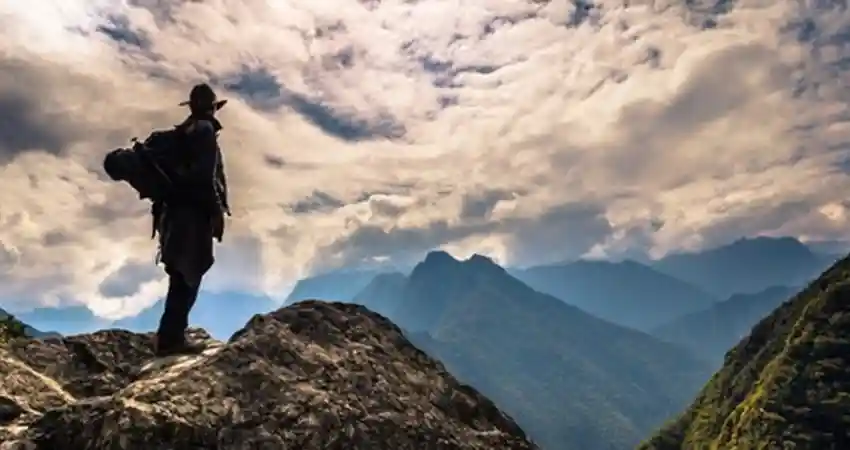
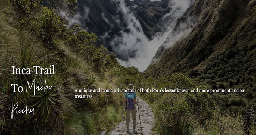
The Inca Trail adventure is undoubtedly one of the most famous hiking options in the world, this trail is as old as the culture itself and allows traditional and historical access to the mysterious Inca citadel of Machu Picchu on top of a mountain in the middle of the Peruvian Andes. The reason why it is useful to know the Inca Trail Elevation Map is because the experience can last several days and although many associate it with a spiritual experience for the disconnection that gives you and at the same time historical places that are known certainly represents one of the greatest physical challenges you can experience during your visit to Peru. This is mainly due to the altitude and it is directly seen as the participants of the experience face a place where the oxygen descends and represents a challenge of resistance so it is important to be prepared for a high adventure and it is much better if you know the Inca Trail Elevation Map.
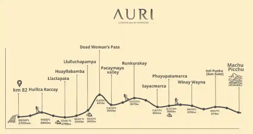
It is estimated that this is one of the greatest challenges that can be found in the Peruvian Andes because from its starting point at 2600 m above sea level it is appreciated as the ascent is noticeable almost immediately reaching even up to 4200 m above sea level which is considered the highest point of the experience in the place called Warmiwañusca which is also recognized as the Paso de la Mujer Muerta (Dead Woman’s Pass).
2.- History of the Inca Trail
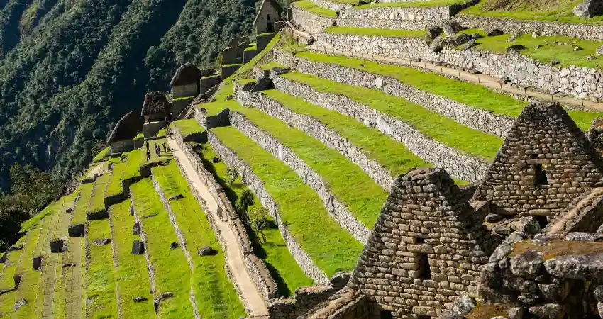
Upon learning about the Elevation Map of Inca Trail it is easy to appreciate the idea that the extensive Inca Trail is actually only a part of the immense network of roads popularly known as the Qhapaq Ñan that allows connection in the vast territory that was once catalogued as the Tawantinsuyo, it is estimated that its construction is more than 500 years old and that the trail had a purpose specifically as a ceremonial route that was used to connect the world with this multifunctional center. This has more than just a spiritual meaning as hikers who walk it can come to appreciate archaeological centers, agricultural terraces and temples that show the sophistication and ingenuity as well as the vast knowledge that Inca engineering had and of course a great biodiversity as well as geographical variety, by observing it within the Inca Trail Elevation Map you can also appreciate the millimetric precision that has allowed its resistance and permanence even through the centuries, seismic movements and erosion.
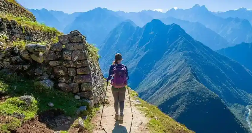
Within the Inca Trail Elevation Map you can also appreciate how the trail passes directly through different types of ecosystems and unique topographic landscapes that range from the subtropical valleys to the high and cold páramos located in the Peruvian Andes. The diversity shown is key to understand also the complexity of how the Incas did not impose their culture in fact they adapted to a hostile terrain where they built suspension bridges, terraces in impossible places and staircases to connect places from one point to another, There is no doubt that many have catalogued this trail as a cultural wonder in fact for the great testimony and traditional heritage seeing how the culture dominated the same geography and imposed it in their favor, each part of the trail is a direct reflection of the broad knowledge they had of the territory and of course also of the respect towards the natural environment and that with the passage of time was captured within the Inca Trail Elevation Map to be transmitted to the whole world.
3.- Why is attitude important?
This is one of the most important and even critical factors for people who plan to enjoy the Inca Trail. As you hike the trail, important factors such as atmospheric pressure cause a decrease in the amount of oxygen, which can have repercussions on the body, creating symptoms such as headaches, nausea, fatigue and, of course, breathing problems, which are directly associated with the popular altitude sickness or “Soroche”. It is for this reason that within the Elevation Map of Inca Trail there are also certain recommendations such as acclimatization which is super important which refers to spend a few days prior to the experience in places with lower altitude, it is also a great idea to drink plenty of water as it allows the body to oxygenate and hydrate at the same time, avoid heavy meals and alcohol will be essential to complement the preparation, remember that the experience is not only a physical endurance but also a mental one, so for many travelers around the world who have taken advantage of the information in the Inca Trail Elevation Map, this experience has become an unforgettable part not only of the trip but also of their lives.
4.- THE INCA TRAIL ELEVATION PROFILE: DAY-BY-DAY BREAKDOWN
It is important to know that the Inca Trail adventure is not only based its idea or purpose on a spiritual experience or connection with the culture, in fact in more than one sense it can be considered as a physical adventure that tests the capabilities of a hiker such as endurance, adaptability and of course to draw a goal that can meet, thanks to the Elevation Map of Inca Trail this is facilitated in a better way because if you know the variation of altitude and terrain you can easily overcome this challenge.
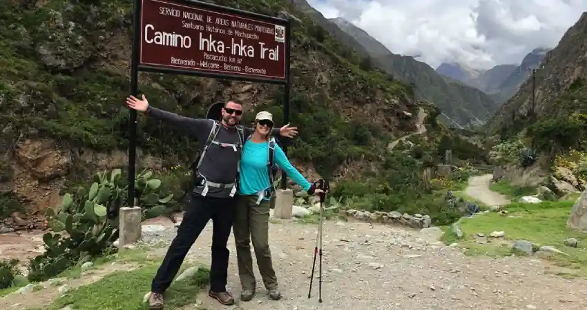
4.1.- Day 01: Piscacucho (Km 82) – Wayllabamba
The starting point is located between the town of Ollantaytambo and Aguas Calientes (Machu Picchu Pueblo). It is traditionally known as Piscacucho and is located at 2600 m above sea level, from this point begins one of the most popular adventures around the world, being the first day is considered one of the softest in terms of physical demand is concerned as the trail has a gradual ascent that does not represent a great challenge which motivates in more than one sense to travelers to continue at a good pace however thanks to the agricultural landscapes and are the two things that can be seen at a glance provides a great landscape. During the tour you can appreciate archaeological sites such as Llaqtapata where you can appreciate the set of terraces and structures also also visit places like Tarayoc and Hatuncancha which are traditional villages and part of ascent to the first camping point known as Wayllabamba which is located at 3000 m above sea level and being surrounded by mountains and extensive vegetation provides a unique place to rest.
4.2.- Day 02: Wayllabamba – Pacaymayo
There is no doubt that this is the most demanding or challenging day, after breakfast begins the strongest ascent of the entire route because
you have to reach the Abra Wamiwañusca or Paso de la Mujer Muerta, this road is steep so it represents a great physical challenge for all travelers also due to the ascent that occur oxygen drops and physical exertion is even more considerable so it is very important to be prepared for this moment. What is perceptible to the naked eye even within the Inca Trail Elevation Map is that this part of the trail is rocky and steep that also provides the experience of crossing cloud forests and even reach the pure Andean where no doubt factors such as cold, dryness and little vegetation are notorious, to overcome the challenge begins the descent in the same way by a stepped path that allows travelers to reach the next camping point known as Pacaymayo located at 3600 m above sea level.
4.3.- Day 03: Pacaymayo – Wiñayhuayna
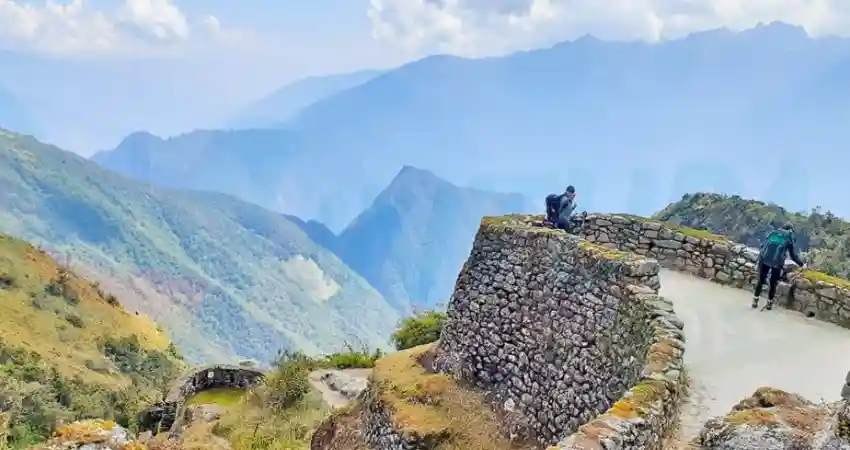
Observing the Elevation Map of Inca Trail we will notice that this day also contains a certain degree of difficulty since the trail leads travelers to first overcome the Runkurakay pass located at 3950 m above sea level, Although the ascent is at a moderate pace, it provides a new challenge for travelers but with rewards because here you can visit the archaeological center of Sayacmarca very important and you get panoramic views, then of course you also get to the pass of Phuyupatamarca where you can also visit the archaeological center with the same name located at 3650 m above sea level. Finally begins the descent by Inca steps through the cloud forest first reaching the collection of agricultural terraces where you can learn more about the agricultural activity that took place during the Inca culture and finally reaching the camping point known as Wiñaywayna which is located at 2650 m above sea level, this is the last night of camping so it is recommended to appreciate the starry sky and the environment full of terraces and Inca structures.
4.4.- Day 04: Wiñaywayna – Machu Picchu
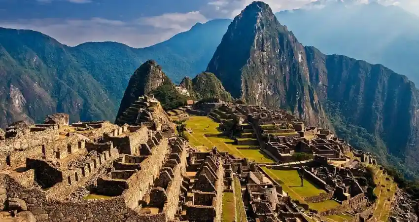
The day begins even before sunrise, in fact we try to start the hike an hour before sunrise as the intention is to appreciate the first rays of the sun from the Sun Gate or Inti Punku which is located 2720 m above sea level, the beauty of this place is undoubtedly that provides the first traditional and iconic view of the Inca citadel in the distance with a morning mist that gives it a mysterious sense. By continuing the trail descends from the sun gate to the city of the Inca located 2430 m above sea level, thanks to its strategic location between the Andean region and the Peruvian jungle you can feel a very special microclimate that varies between warm and humid thus generating a pleasant environment to visit and finally rest from the extensive journey through the mountains.
| “When you reach the summit, you contemplate not only the view, but also the journey that brought you there and the strengths you discovered along the way.” |
5.- PREPARING FOR ALTITUDE CHANGES ON THE INCA TRAIL
Undoubtedly one of the most important aspects to consider during the planning of your next adventure trekking the extensive Inca Trail is that you must understand that altitude can directly affect your body as you reach places that exceed 4000 m above sea level and thus create altitude sickness that can easily be combated by optimal preparation to help you make a difference.
5.1.- Acclimatization strategies
Progressive acclimatization will be fundamental for the body to be able to adequately adapt to the availability of oxygen that exists in the altitudes of the Peruvian Andes, while you are ascending the atmospheric pressure decreases so that each breath directly absorbs less oxygen for this is important that you keep in mind to avoid very intense physical efforts during the first days, it also helps to rest properly in places with lower altitude and of course it is vital to listen to your own body since any discomfort such as headache or insomnia is an important sign.
5.2.- Length of stay
The city of Cusco is located at 3400 m above sea level which makes the city one of the most recommended resting points before reviewing the Inca Trail experience, thus it is recommended to spend in the city between two or three days before the experience, this way you allow the body to adapt easily and you can take advantage of the time to make light hikes, visit nearby places with a lower altitude and above all avoid consumption of substances that may affect oxygen consumption such as alcohol or very heavy food.
5.3.- Hydration
This is one of the most effective strategies you can find, since keeping the body hydrated also allows it to constantly receive oxygen and helps with direct adaptation. It is recommended to drink between 2 to 3 liters of water a day and can also be complemented with local drinks such as coca leaf tea, which is quite traditional in the region and helps with the symptoms of altitude sickness. Try at all costs to avoid caffeine and alcohol as they are directly associated with body dehydration. To this you can add the balance with meals in small portions and of course prioritize complex carbohydrates also known as Peruvian Superfoods which directly provides energy to the body.
5.4.- Medications
Many people believe that to cope with altitude sickness it is also necessary to take medications such as the popular Soroche Pill, however it is not necessary. In fact after verifications it has been registered that this pill contains elements that can represent a risk for some people due to allergies or other components, for this reason it is always recommended as the natural or traditional option. On the other hand if you take personal medications you should carry them with you at all times as long as they have been prescribed directly by your personal doctor, under no circumstances is it a good idea to self-medicate.
6.- A PLACE NEVER DISCOVERED
“Many people are unaware that during the time of the Inca culture, The only reason why the Spaniards who arrived in Cusco in 1532 did not discover it is because with the passage of time one of the last Inca rulers known as Manco Inca led a rebellion in 1536 which produced a massive fire in the access points thus closing the passage and preventing the European conquerors could reach the Inca city located on top of a mountain allowing this could be preserved in a better way.”
7.- FAQs ABOUT INCA TRAIL ELEVATION:
- How high is the highest point on the Inca Trail?
The highest point of the entire trek is in the Abra de Warmiwañusca or Paso de la Mujer Muerta, located at 4200 meters above sea level representing the biggest challenge for travelers.
- Do I need special training to handle the Inca Trail elevation?
You only need to be in good shape to face the challenges of the trail, for this it is enough to take regular walks on a frequent basis and warm up exercises.
- How many days does it take to complete the Inca Trail?
A minimum of 4 days is required to complete this experience, each day is a unique and special adventure.
- What is the elevation of Machu Picchu compared to the Inca Trail’s highest point?
The Inca citadel of Machu Picchu is located at 2430 meters above sea level, on the other hand the highest point is the Abra de Warmiwañusca which is at 4200 meters above sea level.
- Can you get altitude sickness on the Inca Trail?
If it is possible, as you advance on the trail you will feel how the oxygen decreases and directly affects the body, it is good to be prepared in advance to avoid this discomfort.
Now you have the most important information about the Inca Trail and its elevation data that will help to better complement the adventure. Auri Peru can organize a personalized adventure to this popular destination for you and your travel group in a special and exclusive way, contact us now to reserve your space in advance.
“The Inca Trail is not only an adventure, it’s a connection with the soul of the Andes.”